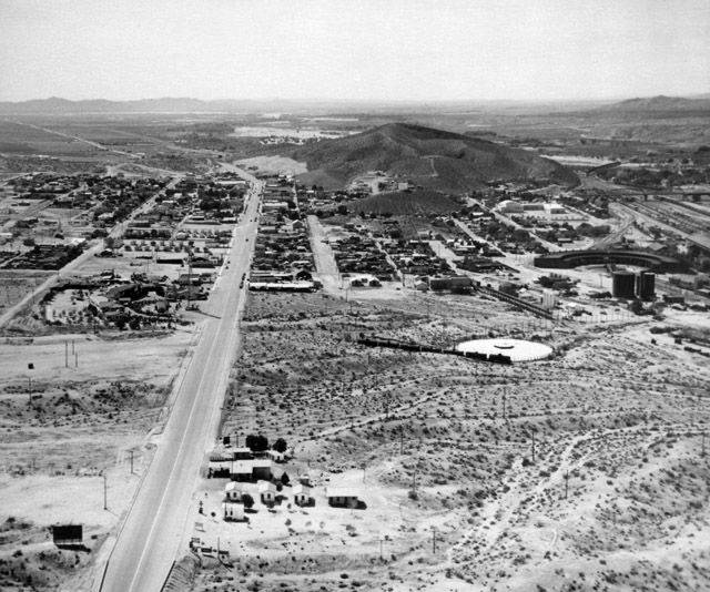
Aerial image of Barstow, CA, circa 1940 looking west. Note Santa Fe Railway yard and engine houses on right. Route 66 runs west towards Victorville through the image.
Media
- Title
- Aerial image of Barstow, CA, circa 1940 looking west. Note Santa Fe Railway yard and engine houses on right. Route 66 runs west towards Victorville through the image.